Using the FME Data Inspector
With the FME Data Inspector it’s easy to open and view any number of datasets and to query features within them.
Viewing Data
The FME Data Inspector provides two methods for viewing data: opening or adding. Opening a dataset opens a new view window for it to be displayed in. Adding a dataset displays the data in the existing view window; this way multiple datasets can be viewed simultaneously.
Opening a Dataset
Datasets can be opened in the FME Data Inspector in a number of ways.
- Select File > Open Dataset from the menu bar
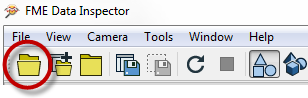
- Select the toolbar button Open Dataset.
- Drag and drop a file onto any window (except the View window)
- Open from within Workbench
Opening data from within FME Workbench is achieved by simply right-clicking on a canvas feature type (either source or destination) and choosing the option ‘Inspect'.
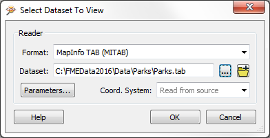
All of these methods cause a dialog to open in the FME Data Inspector in which to define the dataset to view.
Adding a Dataset
Opening a dataset causes a new View tab to be created and the data displayed. To open a dataset within an existing view tab requires use of tools to add a dataset.
- Selecting File > Add Dataset from the menu bar
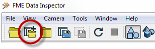
- Selecting the toolbar button Add Dataset
- Dragging and Dropping a file onto the view window
Windowing Tools
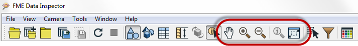
Once data has been opened in the FME Data Inspector, there are a number of tools available for altering the view.
- Pan
- Zoom In
- Zoom Out
- Zoom to a selected feature
- Zoom to the full extent of the data
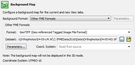
Background Maps
The ability to view maps (or other imagery) as a backdrop to your spatial data is activated by a tool under Tools > FME Options on the menubar.
The background map dialog lets the user select an existing dataset (of any FME-supported format) to use as a backdrop, like so:
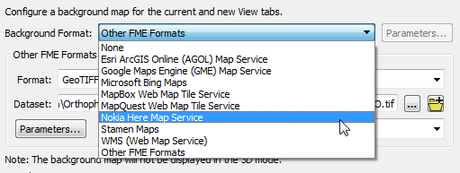
It's also possible to use a number of different web services that supply mapping on demand. Some of these - such as ArcGIS Online - do require an existing account:
| Police Chief Webb-Mapp says... |
When I'm investigating - sorry, inspecting - source data I know it must be referenced against a valid coordinate system for background data to be displayed. If the coordinate system is not recorded in the dataset itself, I can enter it into a field when opening the dataset
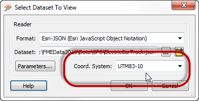
I've also deduced that it doesn't matter what coordinate system the data is referenced against; FME will automatically convert it to whatever system is being used by the background map. |